GIS INTELLIGENCE
Know whose ground you're on
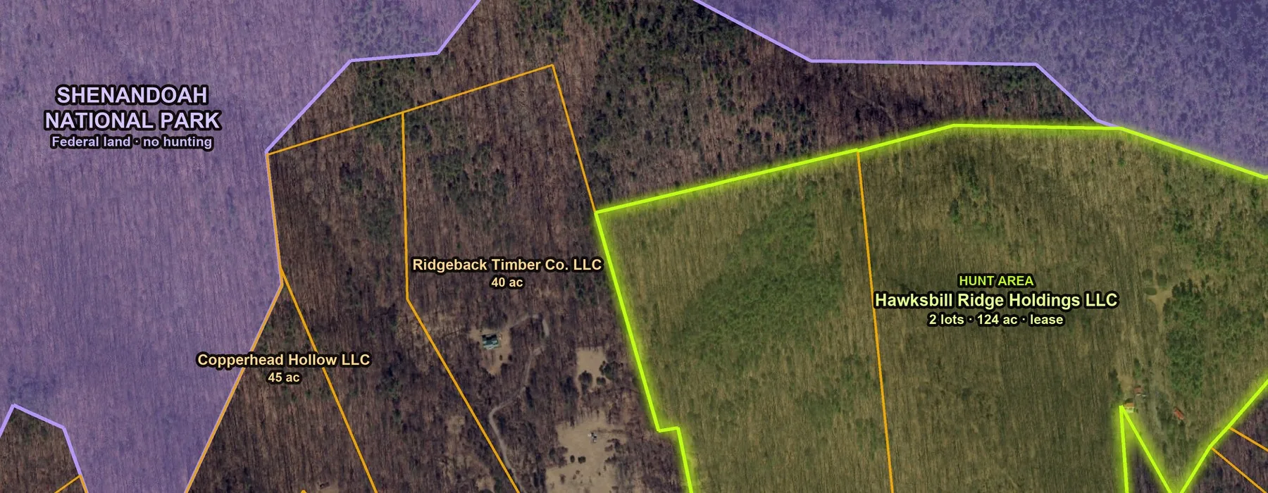
Property lines, owner names, acreage, public land and wildlife areas, layered and live. Hunt Intel curates the rest for your area.
GIS intelligence for hunters · iPhone & Apple Watch
Best-in-class satellite imagery, LIDAR terrain, AI-curated land intel and encrypted off-grid comms, in one app. Know the ground. Track your crew. Own the hunt, with or without a bar of signal.
14 days free, then $9.99 a month or $79.99 a year. Cancel any time.
The full stack
The map, terrain, intel and comms a professional team plans with, built for your lease, your crew and your season.
Property lines, owner names, acreage, public land and wildlife areas, layered and live. Hunt Intel curates the rest for your area.
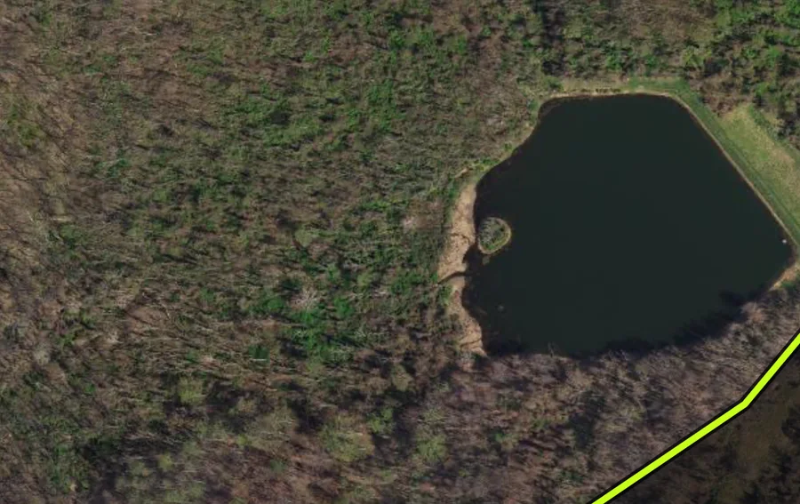
High-resolution satellite and aerial imagery: every field edge, creek and clearing.
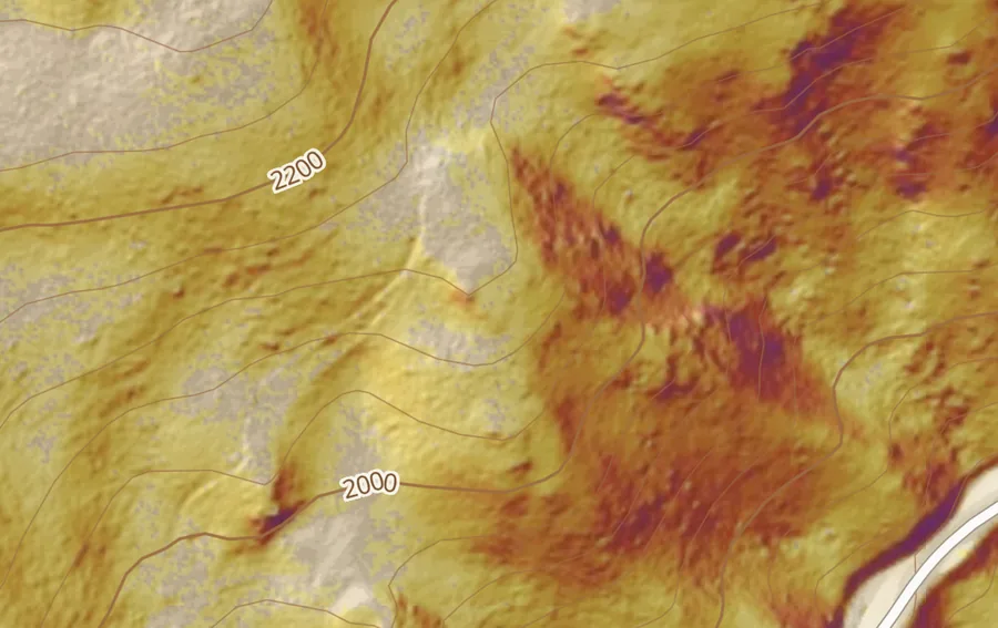
1-meter bare-earth LIDAR: every draw, bench, saddle and funnel, with contours and slope.
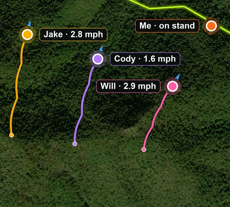
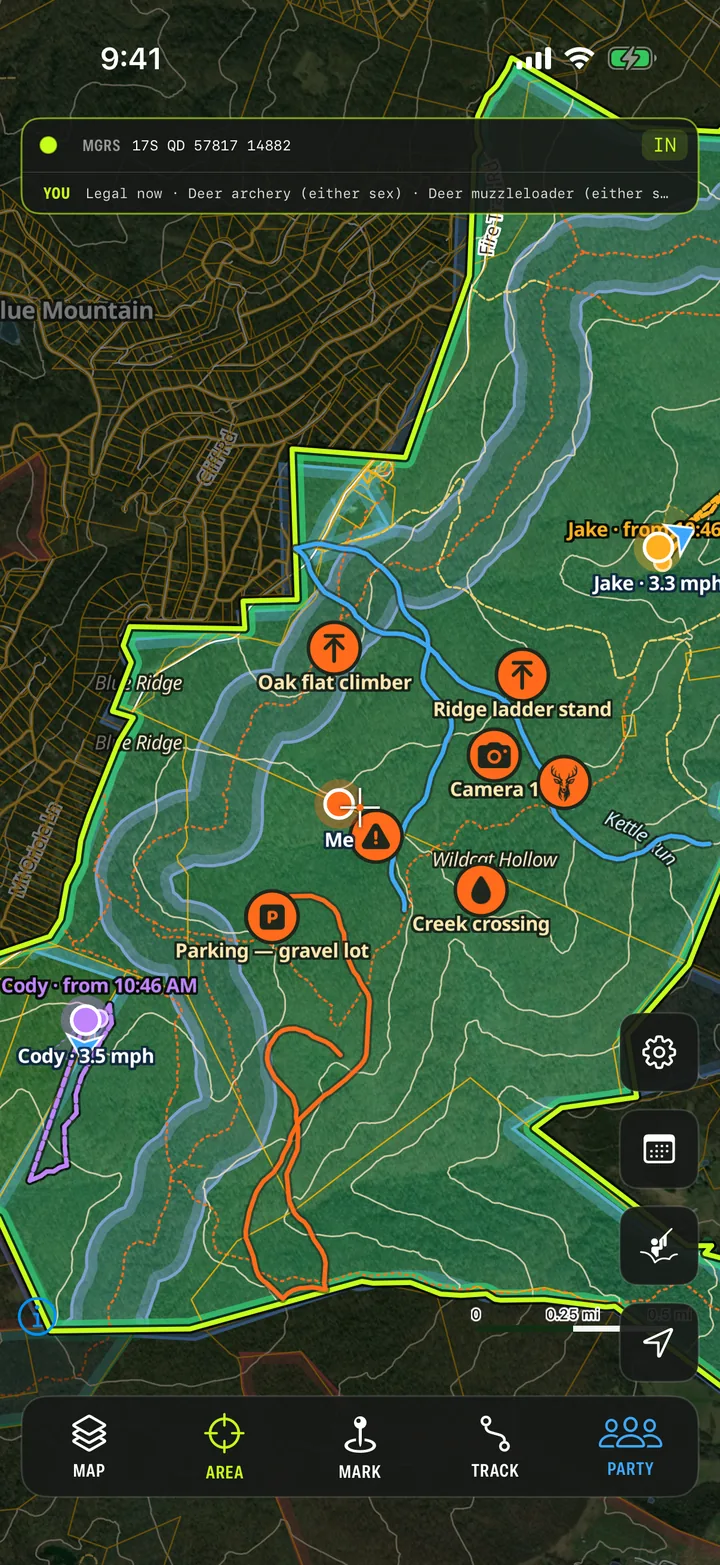
Positions, speed and tracks for your whole party. One tap: on stand, shot fired, deer down.
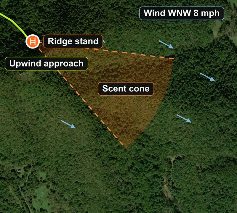
Hourly wind and thermals, with a scent cone from your stand for the hour you pick.
Open seasons and the legal-light countdown for your exact spot, read from your state's own pages.
An encrypted radio mesh carries your crew's positions and texts with no cell service at all.
Draw your lease in seconds
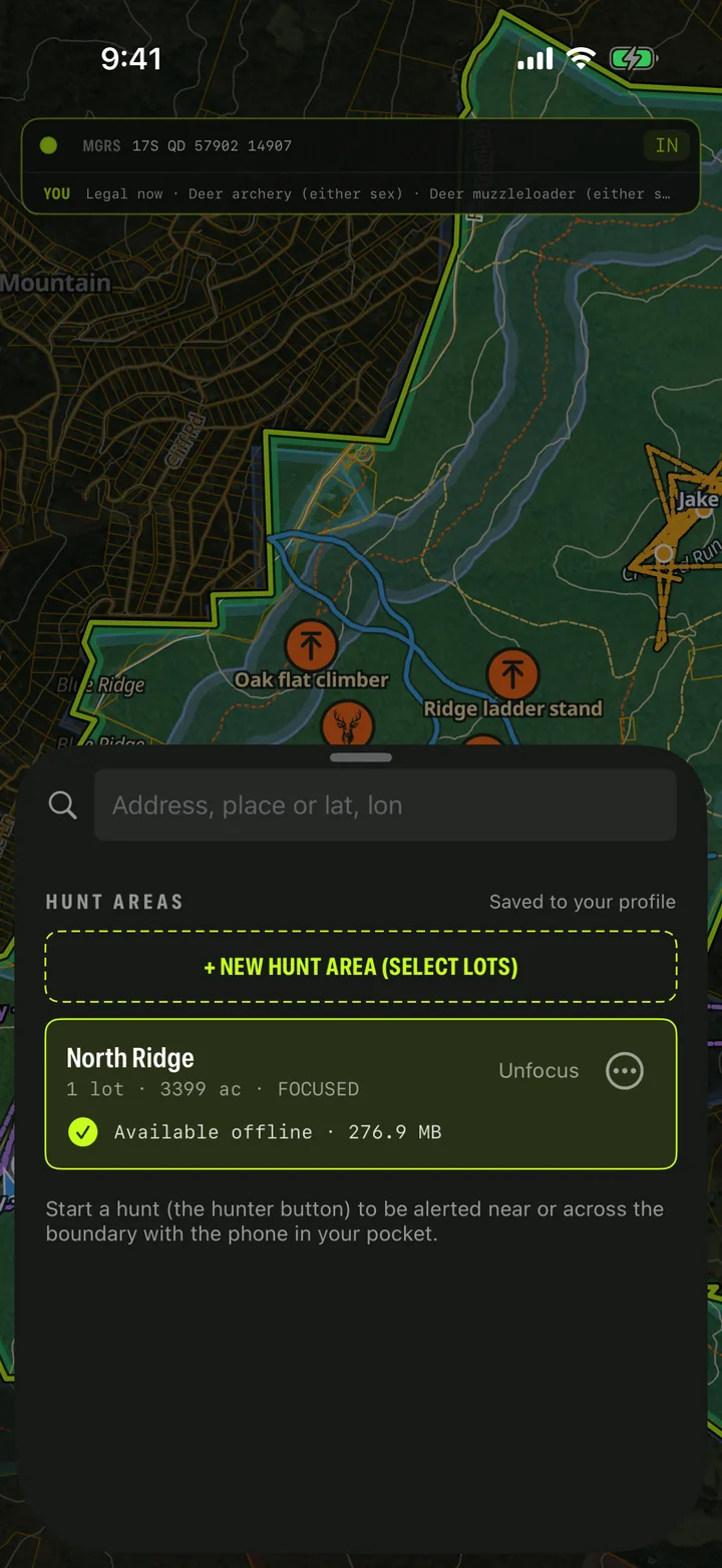
Tap the parcels you have permission to hunt and they become your hunt area: lines, terrain, seasons and wind included. It downloads by itself so it works with zero bars, and you can share it with your party so everyone sees the same boundaries and pins.
Run the drive live
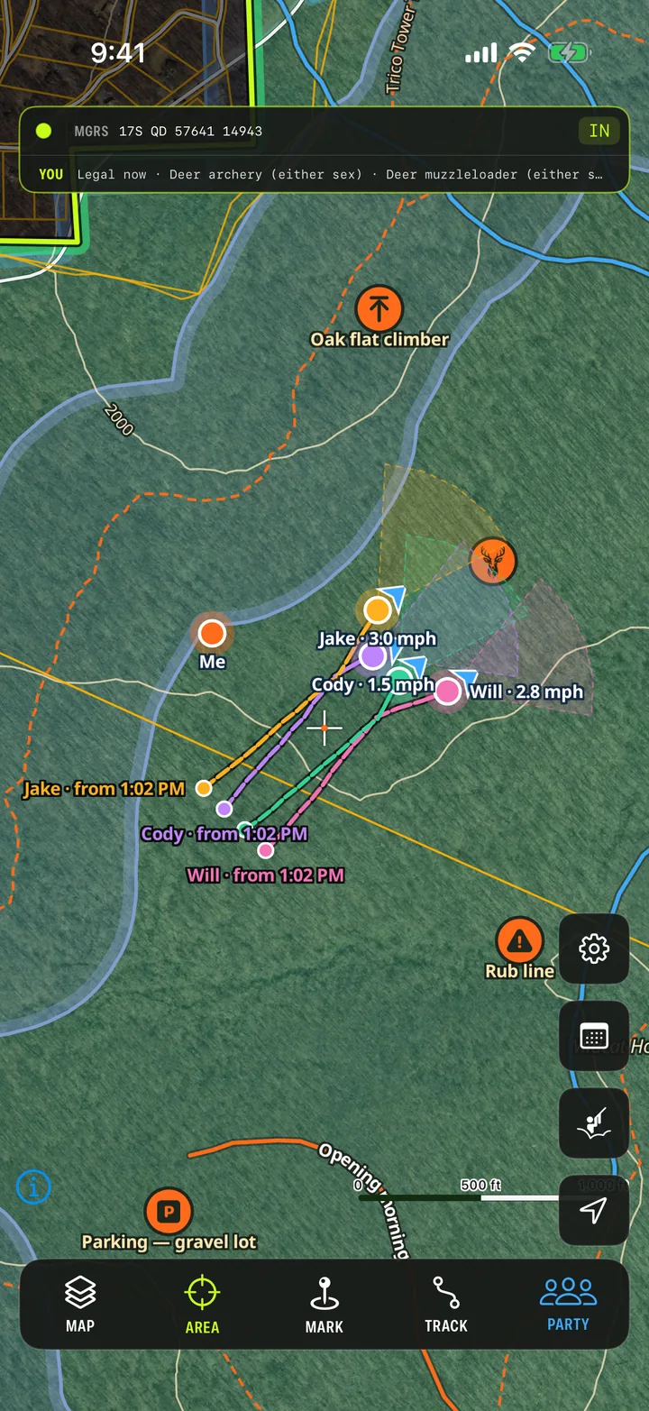
Every hunter in your party shows on the map with their speed and track, so you watch the drive happen: the push through the middle, the flanks swinging wide. One tap tells everyone you're on stand, heading back, or that there's a deer down.
Play the wind
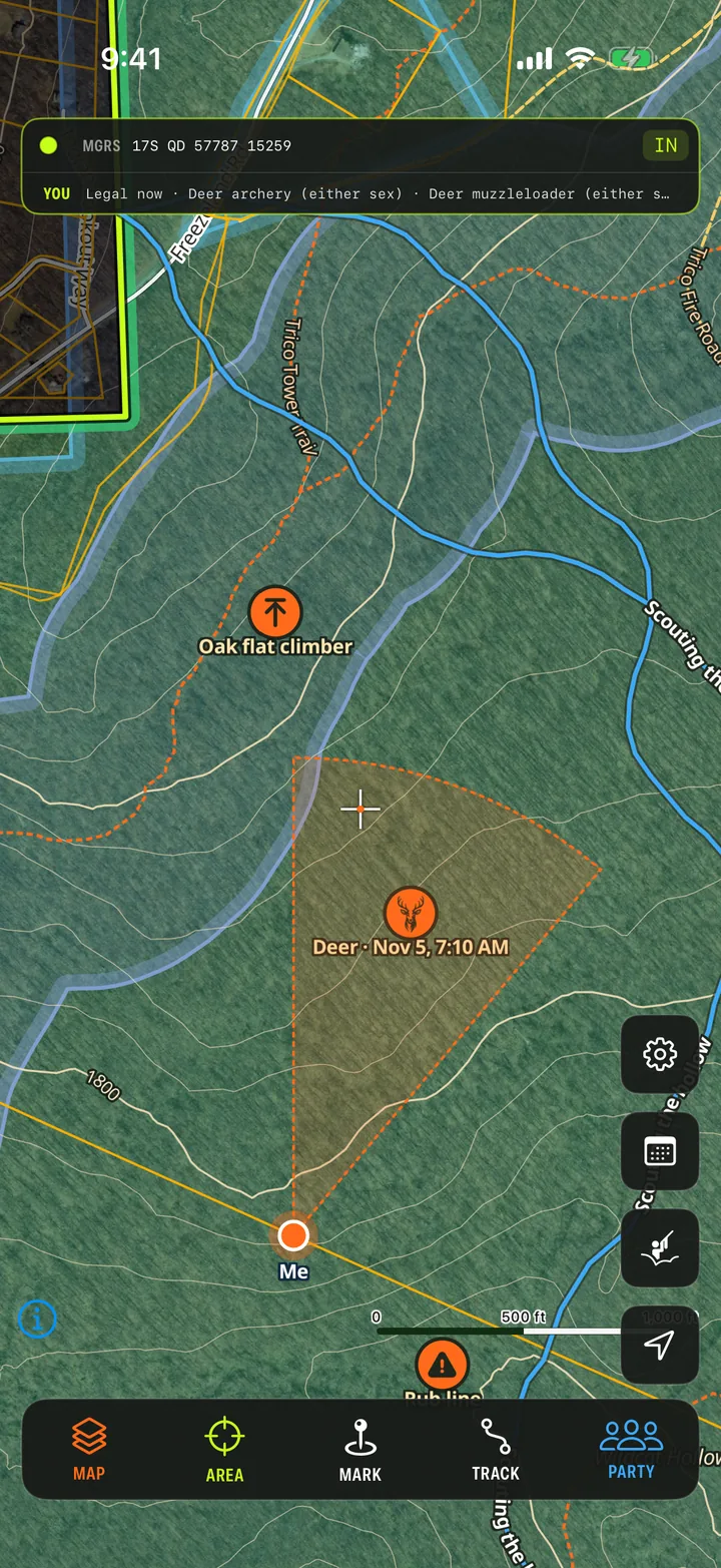
A scent cone drawn from your stand for the hour you pick, from the National Weather Service forecast for your spot, thermals included. Plan your approach before you leave the truck.
AI finds your hunt windows
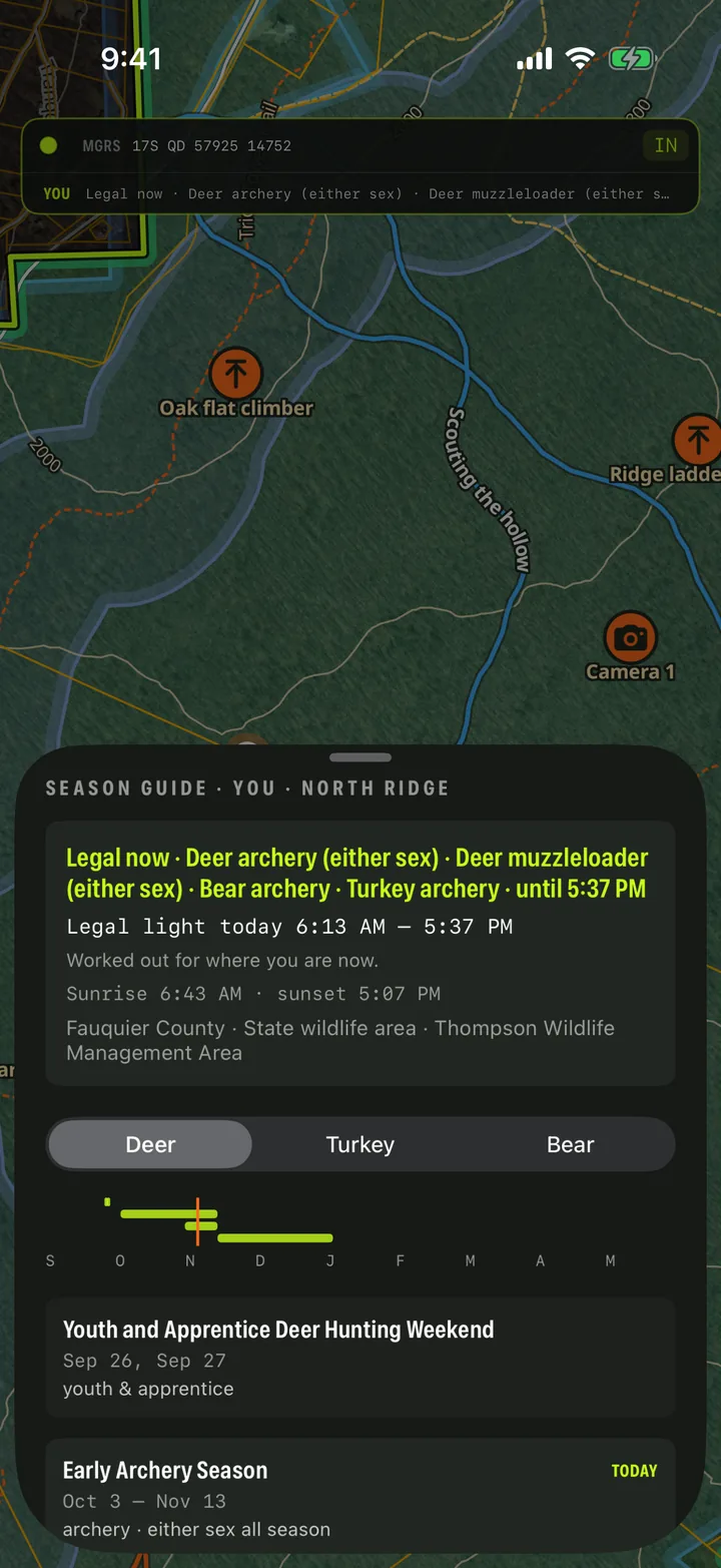
What's open where you're standing, and how long until legal light ends, read fresh from your state wildlife agency's own pages. No guessing which zone you're in or digging through a regulations PDF in the dark.
Hunt Intel, on demand
The map works everywhere. When you need the detail (who owns the lot next door, where the public land starts, what's legal this week), request Hunt Intel for your area from the map.
Our AI analytics get to work right away: tracking down the official property, public-land and season sources for your ground, ranking them, and curating them into custom intel for your hunt area. Verified by experts, delivered to your app within hours. We email you when it's live.
North Ridge lease
Brazos County, TX · 4 lots · 393 ac
AI analytics · verified by experts · delivered to your app
Off the grid, still connected
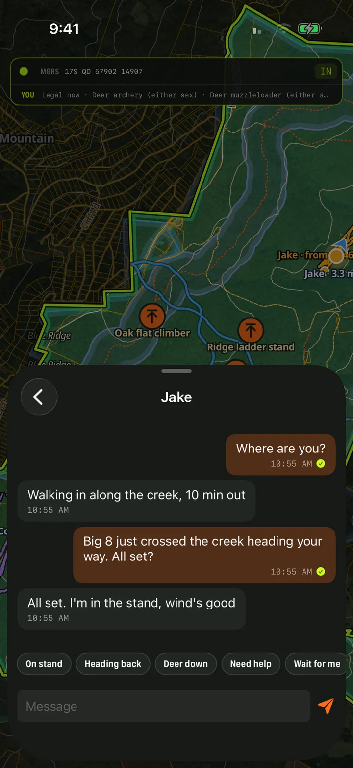
Pair a small Meshtastic radio and your party's messages and positions hop from radio to radio across the woods, with no cell service and no subscription to a satellite plan. The app sets the radios up for you.
Radios are optional. Without one, the app uses your phone whenever you have service.
Apple Watch
Legal light left, your hunt area and the distance to its edge, the wind, and your crew's one-tap messages, on your wrist. Glance, don't dig: complications put the countdown right on your watch face.
YOU
42:00 left
Legal now · Deer (rifle) · until 5:12 PM
📡 Radio GPS ±8 m● REC
To Pond crew
At my position (radio GPS)
Jake
210 yd
Cody On stand 6:02
Jake Big 8 crossed the creek heading your way 7:41
Try it: swipe, tap, press the orange button
How it works
Tap Areas, then the lots you have permission to hunt. Property lines, terrain, seasons and today's wind come with it, and it downloads for use with no signal.
Add friends by their code and put them in a party. A party is who sees you on the map; friends alone share nothing.
Tap the hunter button and pick your party. That shares your position and records your track, until you end the hunt.
Pricing
$79.99/year
$6.67 a month, billed once a year
$9.99/month
Billed monthly
Everything is included: every map layer, Hunt Intel requests, your party, radios, offline maps, the Watch app and the website. 14-day free trial; cancel any time.
One account works on iPhone, Apple Watch and the web, whichever you start with.
Yes. Your hunt areas download to your phone automatically, so the map, property lines and your waypoints work with zero bars. To see your party with no service, pair a Meshtastic radio; positions and messages then travel radio to radio.
Anywhere you hunt. Satellite maps, terrain, offline downloads, your party and the radio mesh work wherever you are. Property lines and owner names already cover much of the US, and for the full detail on your ground (ownership, lot details, public land and seasons) you request Hunt Intel from the map.
Custom land intel for your hunt area. Request it from the map, and our AI analytics find and curate the official property, public-land and season sources for that area; verified by experts and delivered to your app within hours. It's included in your subscription.
No. Without one, the app shares your position over the internet whenever you have service. A radio adds positions and chat where there's no signal at all.
Only the people in the party you start your hunt with, and only while your hunt is running. Friends alone see nothing. Your hunt areas, pins and tracks are private unless you share an area with your party.
Yes. The same account works on the web at app.darkgrid.cloud, handy for planning on a big screen.
Yes. Foridian Hunt is now DarkGrid Hunt: same app, same account and same subscription, with a new name.